As part of its project ""Revealing and Advocating Multicultural Heritage of Anatolia"" that started in 2015, Hrant Dink Foundation created an inventory of monasteries, churches, schools, synagogues, hospitals, orphanages and cemeteries and collected and recorded data regarding these buildings. The project is aimed at developing an alternative model that can set an example for other projects that are geared towards protecting and renewing cultural assets in today’s Turkey.
Since the first months of 2014, the project team has conducted research to create an inventory with the help of several sources. In the first stage of the project, buildings that belong to Armenian people were identified using the list of Armenian churches and monasteries that was prepared between 1912 and 1913 by the Armenian Patriarchate of Istanbul to be submitted to the Ministry of Justice and Religion (Adliye ve Mezahib Nezareti), archives of Agos Newspaper; and postcards that were compiled by Osman Köker. The research, which first focused on buildings that belong to the Armenian culture, has later on been expanded to include the Greek, Jewish and Assyrian cultural heritage. Church books were the most useful sources. The team also worked on the Ottoman Archives of the Prime Minister’s Office. (Başbakanlık Osmanlı Arşivi).
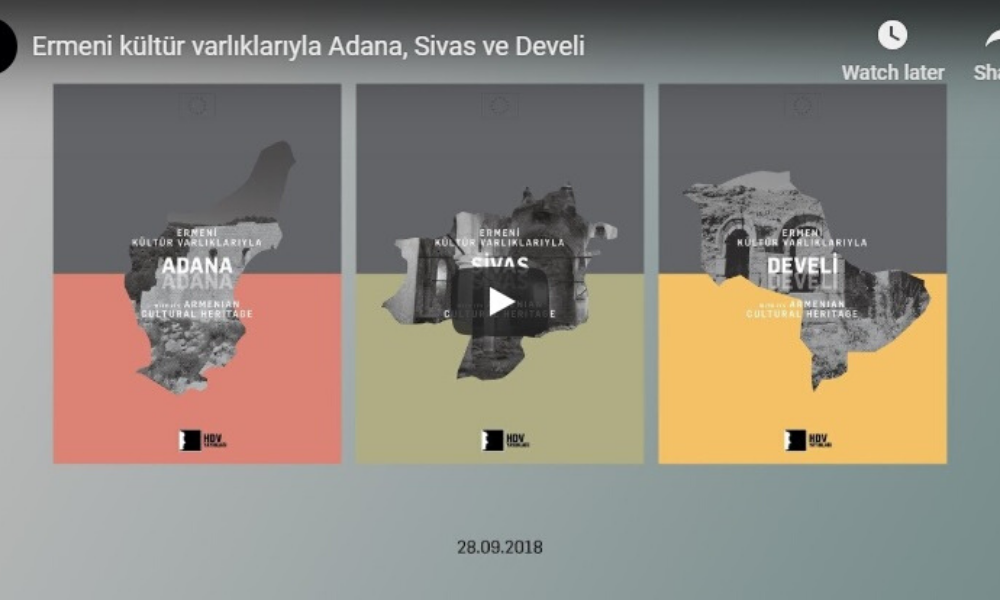
Continuing to work on cultural heritage since its foundation, the Hrant Dink Foundation carries out the Turkey Cultural Heritage Map and Adaptive and Creative Reuse of Sites of Memories projects. As a result of these efforts, books titled Ermeni ve Rum Kültür Varlıklarıyla Kayseri (2016), (Kayseri with Its Armenian and Greek Cultural Heritage) 2012 Beyannamesi: İstanbul Ermeni Vakıflarının El Konan Mülkleri (2012), (2010 Declaration: The Seized Properties of Armenian Foundations), Habap Çeşmeleri (2012) (Habap Fountains), “Batılılaşan İstanbul’un Ermeni Mimarları (2016)” (Armenian Architects of Istanbul in the Era of Westernization) “Ermeni Kültür Varlıklarıyla Sivas (2018)” (Sivas with Its Armenian Cultural Heritage), “Ermeni Kültür Varlıklarıyla Adana (2018)” (Adana with Its Armenian Heritage) ve “Ermeni Kültür Varlıklarıyla Develi (2018)” (Develi with Its Armenian Heritage) were published from the foundation’s same-title publishing house. The Turkey Cultural Heritage Map is regularly updated with data derived from the research and inventory studies conducted during the project.
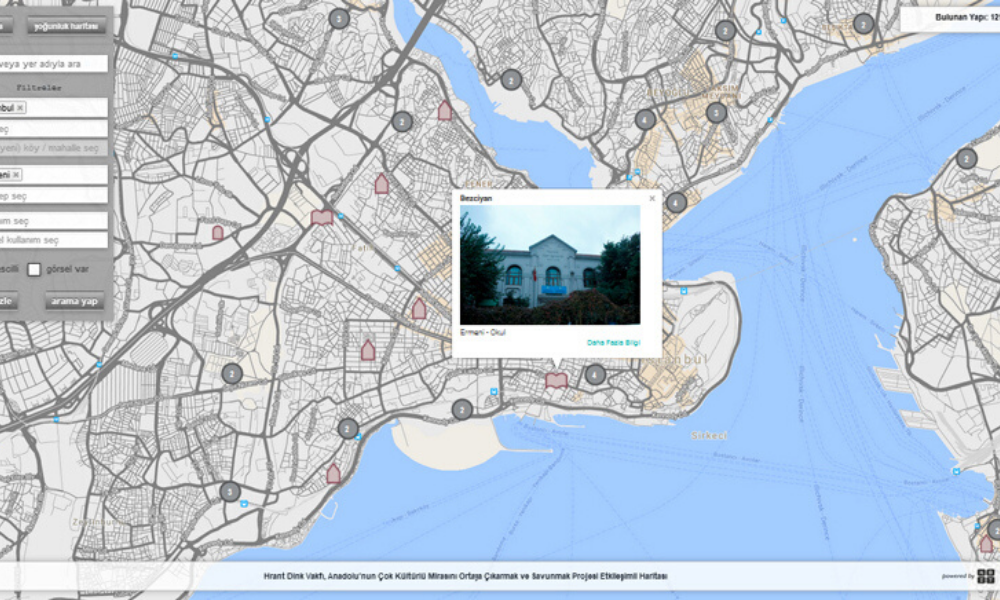
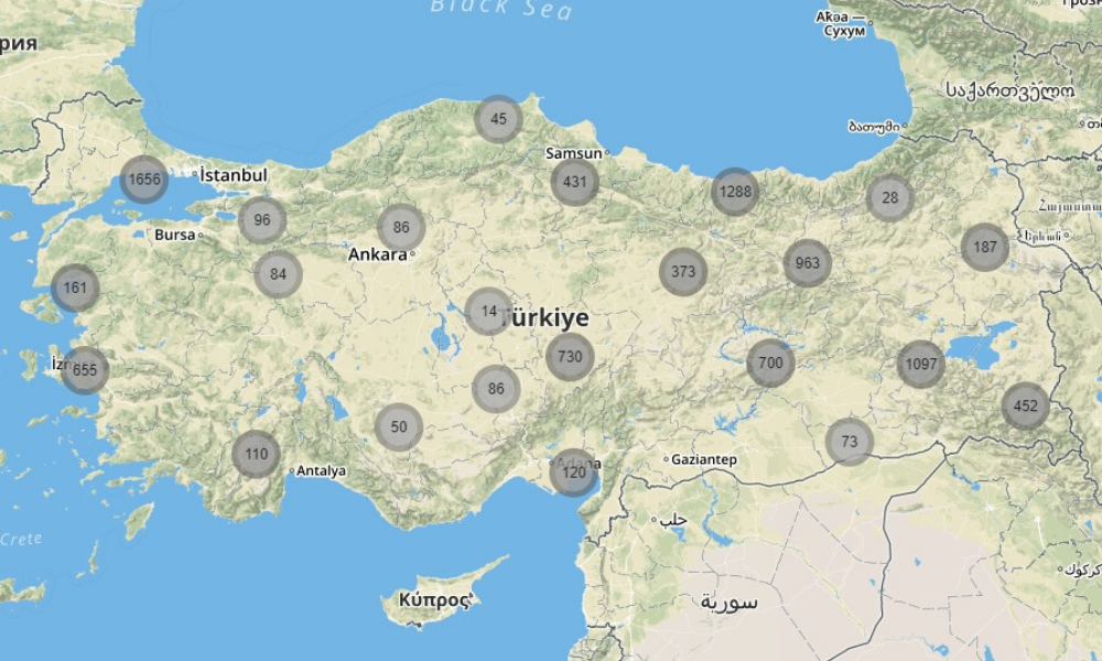
Turkey Cultural Heritage Map is an interactive map which aims to bring Anatolia's multi-cultural heritage into the open and defend it. It is possible to see and examine Armenian, Greek, Assyrian and Jewish places of worship, schools, hospitals and cemeteries on the map. When the inventory work is completed, it is aimed that the online map would be open for the use of everyone. The inventory includes the heritage of 4600 Armenian, 4100 Greek, 650 Assyrian, and 300 Jewish societies, a total of nearly 10 000 buildings. Some are still standing, others have been burned, destroyed, or turned into warehouses, warehouses or mosques.
The starting time period chosen for the classification of Armenian heritage is AD 301, when Armenians chose Christianity as their state religion. For the Jewish heritage, AD 70, the year of the second major migration in the Mediterranean, AD 70 was picked up. For the Assyrian inventory, year AD 37 was selected as the time when they became Christian and the “Eastern and Western Churches” were separated. The Greek cultural inventory includes the Republican and Ottoman periods, in addition to the Byzantine period, starting in AD 330, when the Eastern Roman Empire officially separated its capital by moving it to İstanbul and Christianity started to be given privileges.
The aim of the project is to increase awareness about the diversity of Anatolian cultural heritage and show how many sites need to be protected. The working group of the project point to the fact that even those buildings designated as sites to be protected are in shambles, unprotected and often vulnerable to treasure hunters' digging operations. In addition, despite the Cultural and Natural Heritage Conservation Boards present all over Turkey, their inventories are not exhaustive, holding many gaps. In Kayseri for instance, the official inventory shows 30-35 buildings, while The Hrant Dink Foundation has found that there are actually 130 buildings that constitute the cultural heritage and need to be protected.
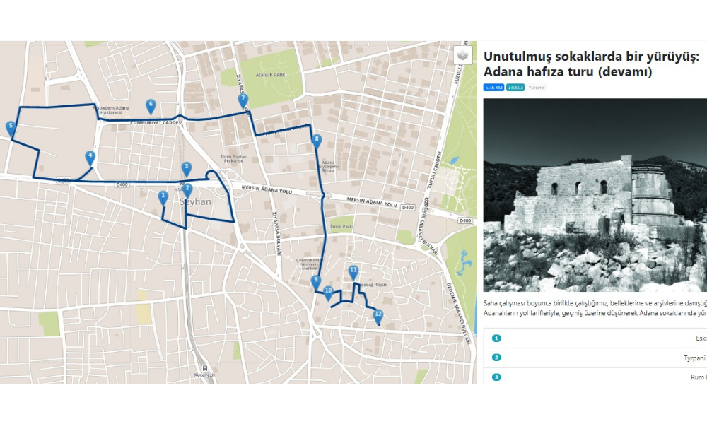
The team working on the project wants to make sure that the map is an interactive, living piece of work. Within this framework, memory tours were organized in Adana, Sıvas and Develi under the name ‘A Walk through the Forgotten Streets’, and 360 degrees (panoramic) pictures and sections from oral history interviews were added to the map. The project coordinator Vahakn Keshishian points out that due to the interactive nature of the map, anybody and everybody can be included in the project. Visitors can share whatever relevant resources they may have, or send information and/or photos on structures/buildings that may not be on the list. Such information is kept as data by the working group and the map is updated regularly.
The map has followers from both within and outside Turkey. Often, the users may ask questions about their former neighborhood, or, otherwise share whatever relevant information they may have. The main users of the map, however, are researchers.
The Hrant Dink Foundation also undertakes new studies in the light of the Turkey Cultural Heritage Map. Within the Cultural Heritage Project, KarDes (multicultural mobile application) aims to make Istanbul multilayered and multicultural heritage visible via memory tours. Inspired by the Foundation's earlier research, this application offers the visitor (user) to take a tour in Istanbul oldest neighborhoods and discover the city's cultural inventory heritage. Supported by oral history conversations, these tours give a chance to learn about a neighborhood via the voices of individuals who lived or are still living there. Also included in the application will be the Istanbul Inventory from the Turkey Cultural Heritage Map. This will allow the visitors to access the cultural inventory from the app.
The Foundation collaborates with local municipalities and civil society organizations. The work progresses with the addition of new data and the information is shared with local municipalities in the area.
The project team had to go to the “Asia Minor Research Center” in Athens for the Greek resources and to the Mesopotamian Library in Sweden for the Assyrian ones. Another problematic area in the research are place names. This is what they had to say about it: “We worked within the province boundaries of today. Since the old archives do not follow the new one, we conducted a separate study. It was quite a job to compare and recognize old names from the new ones.”
The team claims that it is relatively easy to access realistic information up to the 1920s, but quite difficult for more recent history. The main reason for the difficulty lies in the lack of continuing institutions, the scarcity of written resources and hence the loss of historical information. Since the minorities lacked a common information and memory center, it is difficult to find information other than in Turkish. For instance when the library of a Greek Literature Association was confiscated, much of the unity of historical information was lost for good. In addition, due to lack of follow-up search in churches and other public buildings, all information concerning a period becomes easier to loose.
The most essential difficulty in such memorialization work is the classification of cultural heritage. In an interview Vahakn Keshishian and Zeynep Oğuz explain this as follows: “Sometimes building structures are multi-functional or or could have been used for diverse purposes in different periods. Or, for instance, when we take the issue of ownership, what are the absolute minimum conditions to call this building an Armenian one? Is it that the architect was Armenian? Or that it was built by Armenian craftsmen? Or that it was located in an Armenian village? Or that it was used by Armenians? There are some buildings, for instance, that have been rented and are being used as synagogues, but the owner is not a Jewish foundation. Do you call this a Jewish heritage or not?”
Most of the information concerning the coordinates of buildings is not precise. One reason for this is the impracticality of field work for all regions, and another is the concern that data shared on maps may be used by treasure-hunters., However, although the practice of treasure hunt has been observed during fieldwork, the research group add that oftentimes it is difficult to determine who did it, or why. “Many times, unfortunately, we find that archeological digs or renewal and protection work may often contribute to a larger scale of depredation.”
The Hrant Dink Foundation published a statement in 2021. It announced that information had reached them to the effect that the Map of Turkey's Cultural Heritage had been used in treasure hunting. In their statement the Foundation said the following: “May we remind you that there is no need for a map to locate a standing building; on the other hand, we regret to inform you that those buildings located on the map, even the remnants of which no longer exist, are not located along the coordinates you believe and therefore necessitate the digging of a whole village. May we suggest that at least you plant seeds in those places that you dig and water the area so that all your efforts are not in vain”. Hrant Dink’s article titled the “Definition of Treasure’’ published on Feb. 18, 2000 in Agos was also included there.
